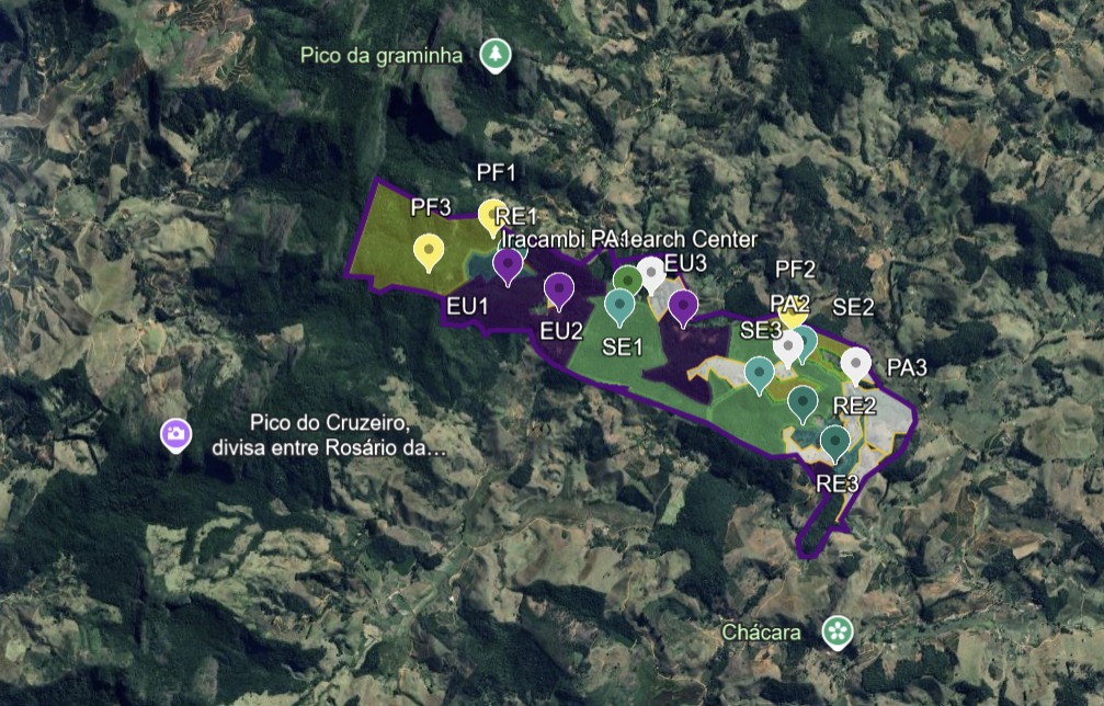
This interactive map shows the entire area of Iracambi Farm and the different land uses that make up our landscape: fragments of primary old-growth forest, regenerating secondary forests, areas reforested with native species, eucalyptus plantations and pasture. Explore this map to understand the diversity of ecosystems available for study, as well as the mountainous terrain, watercourses and our proximity to Serra do Brigadeiro State Park. This diversity makes Iracambi a unique place to conduct research on conservation, restoration and sustainable development. The map was developed with the support of the University of Bologna.